

The Ice Age Didn’t Provide Tualatin’s Only Floods
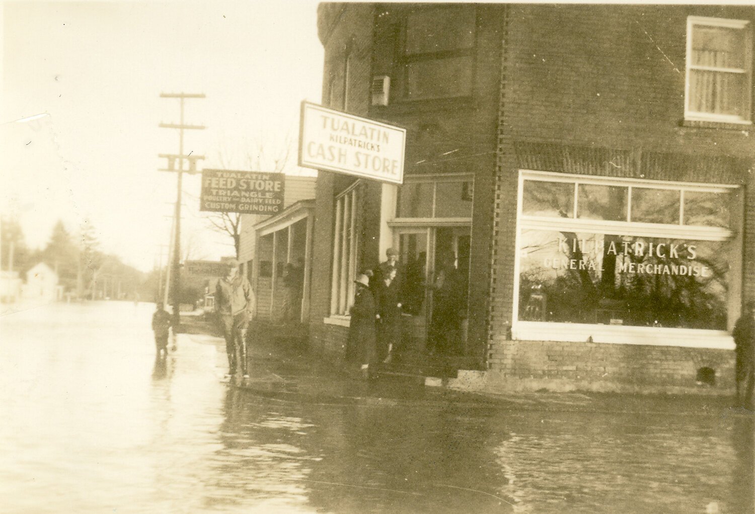
1937 flood at the doorstep of Kilpatrick’s Store—now Mashita’s and the VFW
Six major floods have occurred on the Tualatin River at Durham since the USGS established a stream gage at West Linn in 1928. Those floods occurred in December 1933, December 1937, December 1955, December 1964, January 1974 and February of 1996.
During the 1996 flood, waters affected 29 homes, 97 multi-family units, and 85 commercial/industrial buildings in Tualatin, according to city figures. That doesn't include affected homes in the Hazelbrook neighborhood, which lies in unincorporated Washington County.
As the river level rose, the city declared a state of emergency and distributed evacuation notices to residents living along the Tualatin River and in the Roamer's Rest RV park off Pacific Highway. The river finally ran amok Thursday night, rising at a rate of 6 inches per hour and reaching a high of 126.3 feet above sea level Friday at midnight before beginning a slow retreat.
That's more than 2 feet above the 100-year floodplain. The river's normal winter level is 106 to 108 feet above sea level, according to the city. Hundreds of volunteers joined forces with city crew, Tualatin Valley Fire and Rescue, and local and state police to build mini-dams out of 20,000 sandbags, evacuate flood victims and close off streets.
The American Red Cross set up an emergency shelter at Living Savior Lutheran Church up on Sagert Street, just blocks from the flooded downtown. A water rescue team plucked stranded families from their homes, though other residents chose to stay put and stick it out.